Motivation
RETINA is a navigation system to assist people with visual impairment navigate buildings. The project utilizes Ultra-Wide Band (UWB) to offer submeter precision and integrates with OpenStreetMaps to take advantage of the existing tools that support OpenStreetMaps to enable community built maps.
The solution consists of three major components:
- The Ultra-WideBand (UWB) transceiver
- The mobile app
- The server
Ultra-Wide Band (UWB) Transceiver
The hardware used in the project is Decawave’s DWM1001 UWB/BLE transceiver. The Bluetooth Low Energy (BLE) connection is used to communicate location data from the device to the user’s smartphone.
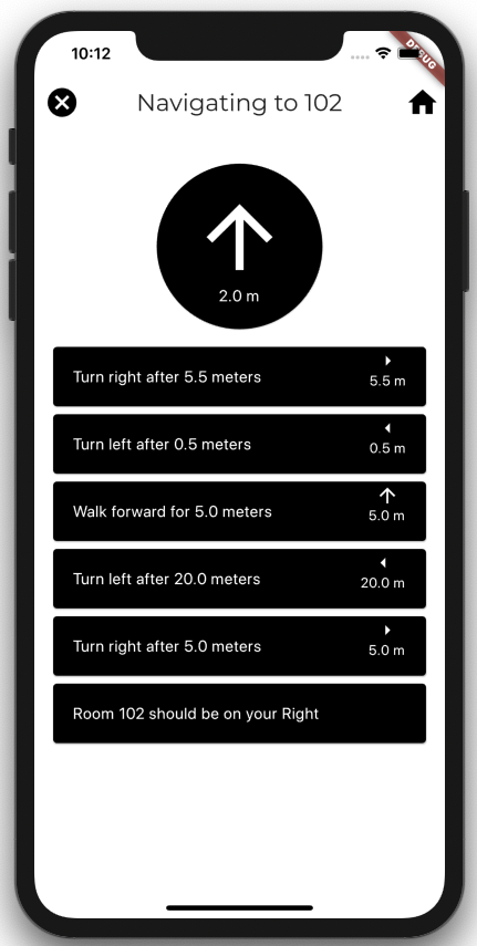
The Mobile App
A cross-platform mobile app supporting both Android & iOS and built using flutter.
The source code for the app is available on Github.
The Server
Consists of two main components: